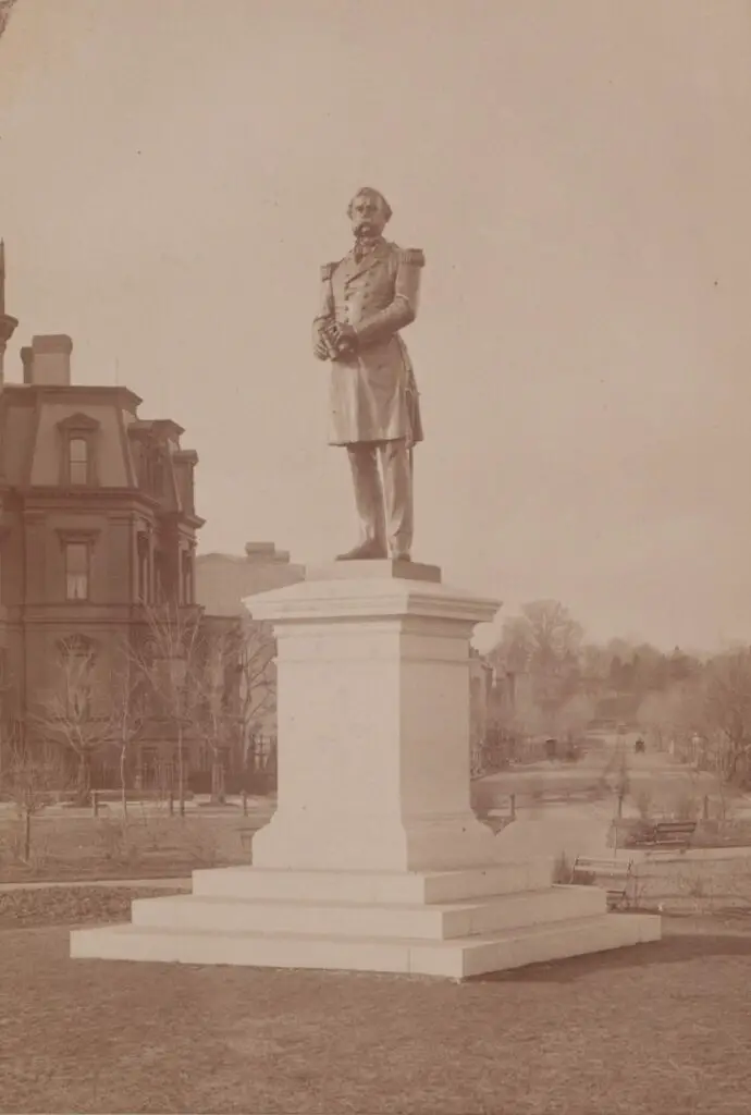
The original statue of Samuel DuPont sat for more than a generation at the center of Dupont Circle. Then it was removed because people thought it was ugly. Read the story to learn more.
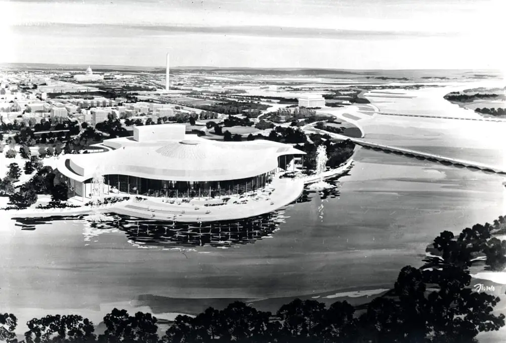
Take a look at the proposed design for the Kennedy Center and the history behind it. Learn how the idea for a national cultural center dates back to 1933 and how it eventually became the Kennedy Center we know today.
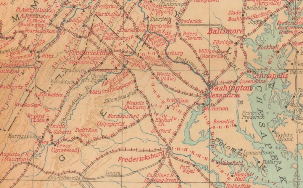
This is one of the more fascinating maps we have come across. It shows every single location George Washington visited during his life, all up and down the east coast. From Savannah in the south to Kittery, Maine in the north. The map below was done by the National Geographic Magazine in honor of the first president's 200th birthday.
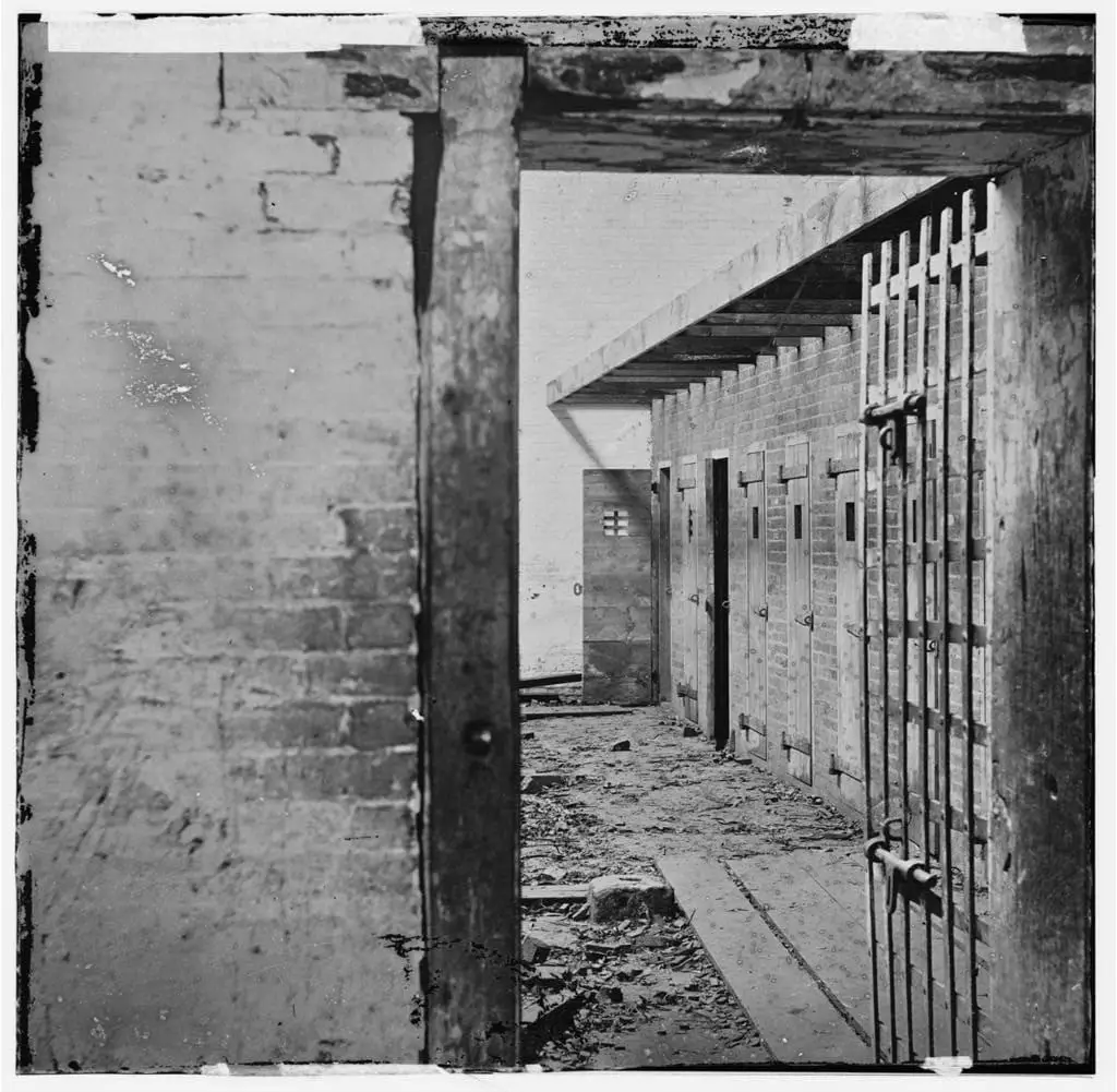
Uncovering the sad truth of the past, Slave Pens existed in and around all of Washington in the 1860s. This photo shows one of those in Alexandria during the 1860s. Learn more at the Library of Congress.
Take a look at this incredible 1922 photo of Washington, D.C. taken from the air. Click on the image for a larger version and explore the city's history up close!
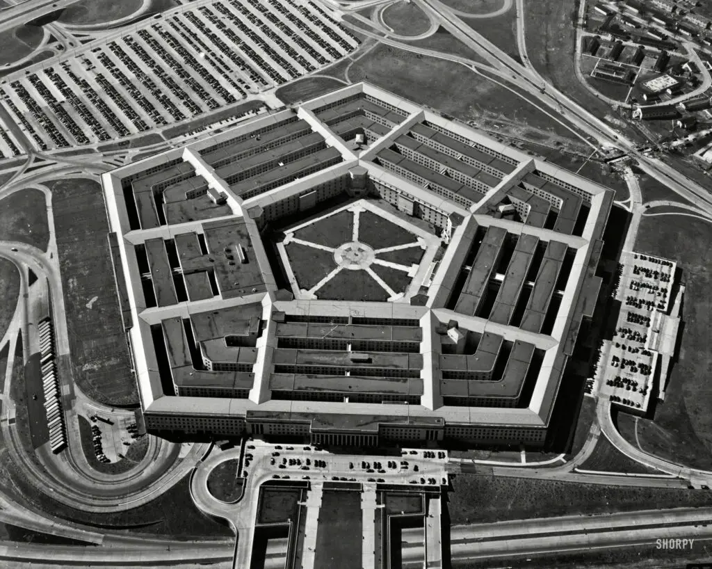
Get a birds-eye view of the Pentagon from the 1940s with this rare photo. Enjoy a glimpse of a bit of history and the War Department with this aerial shot captured by Theodor Horydczak.
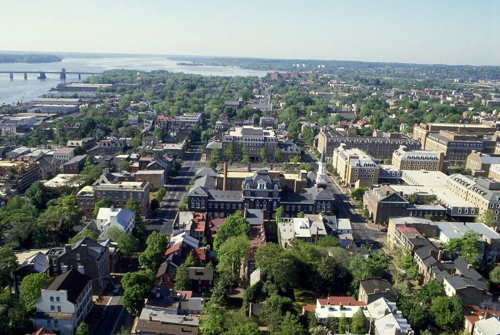
Take a trip down memory lane and see Alexandria, Virginia in the 1980s with this aerial view from the Library of Congress. See if you can recognize parts of the city!
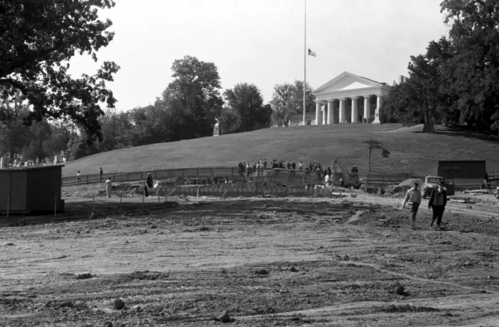
Take a look back at the construction of JFK's Eternal Flame Memorial at Arlington National Cemetery in 1965. This fascinating old photo shows the site before the iconic memorial was completed.
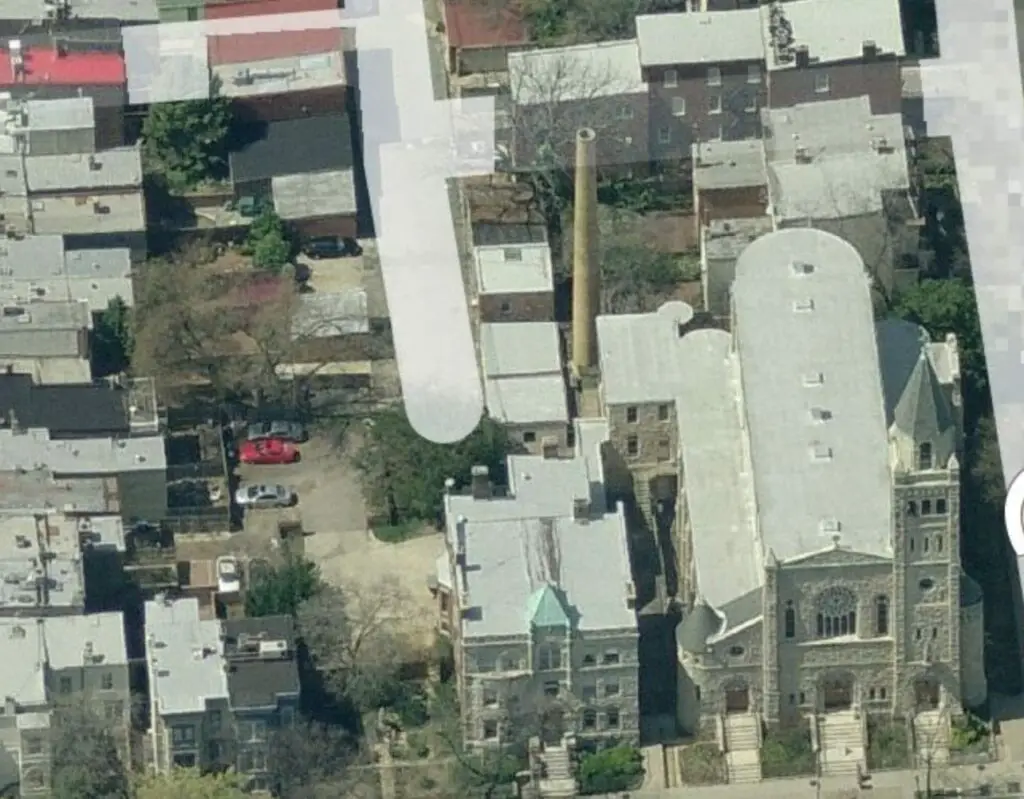
Discover the mystery of the smokestack on Capitol Hill! An image sent to us by GoDCer Geoff and a satellite view from Google Maps help us to unravel this mystery. Check out the 1921Baist map and share your thoughts in the comments!
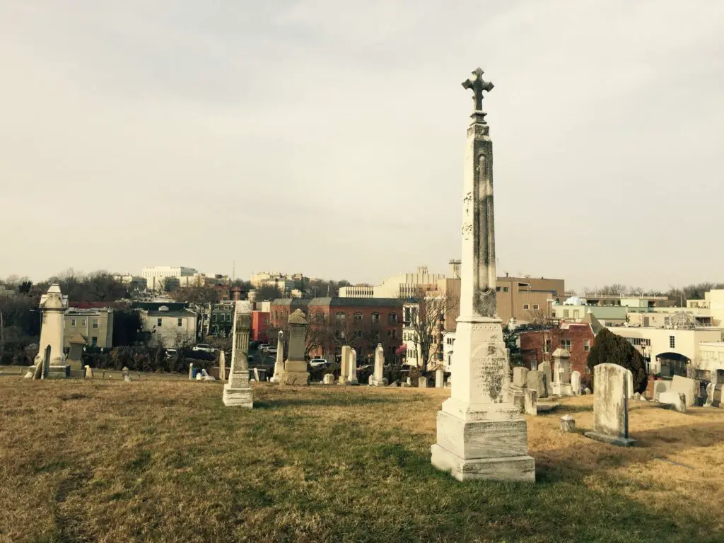
Take a stroll through one of D.C.'s less visited cemeteries, Holy Rood Cemetery, and discover the stories behind the names on the headstones. From prominent doctors to Irish immigrants, uncover the past lives of the city's regular Washingtonians.
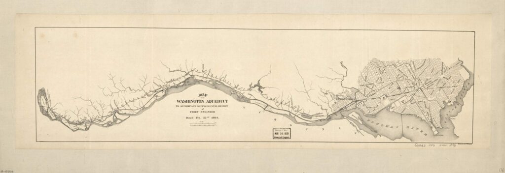
Check out this amazing Civil War-era map of the Washington Aqueduct. See how the Aqueduct and the C&O Canal looked in 1864. Source: Library of Congress.
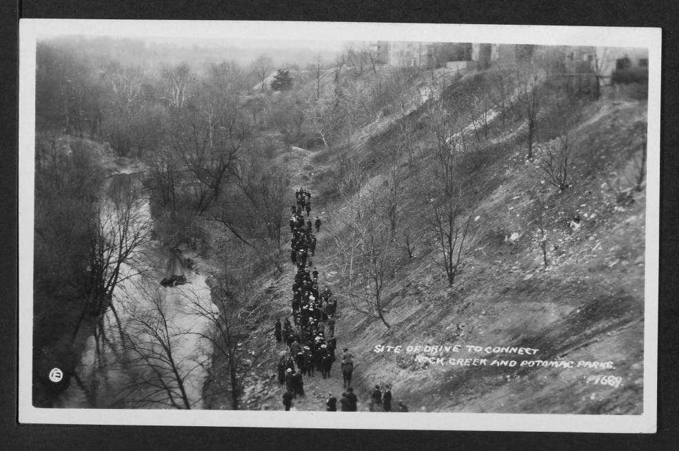
Take a journey through history with us and explore the historical entrance to the National Zoo in Rock Creek Park. Learn more about the area and its past with us today.